
允景洪街道 topographic map
Interactive map
Click on the map to display elevation.
About this map
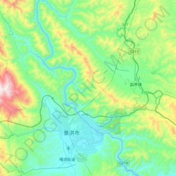
Name: 允景洪街道 topographic map, elevation, terrain.
Location: 允景洪街道, 景洪市, 西双版纳傣族自治州, 云南省, 666100, 中国 (21.92528 100.70424 22.23593 100.92767)
Average elevation: 2,913 ft
Minimum elevation: 1,706 ft
Maximum elevation: 6,772 ft
Other topographic maps
Click on a map to view its topography, its elevation and its terrain.