
嘎洒镇 topographic map
Interactive map
Click on the map to display elevation.
About this map
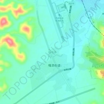
Name: 嘎洒镇 topographic map, elevation, terrain.
Location: 嘎洒镇, 景洪市, 西双版纳傣族自治州, 云南省, 666100, 中国 (21.94028 100.74130 21.98028 100.78130)
Average elevation: 1,850 ft
Minimum elevation: 1,772 ft
Maximum elevation: 2,133 ft
Other topographic maps
Click on a map to view its topography, its elevation and its terrain.