
景哈哈尼族乡 topographic map
Interactive map
Click on the map to display elevation.
About this map
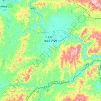
Name: 景哈哈尼族乡 topographic map, elevation, terrain.
Location: 景哈哈尼族乡, 景洪市, 西双版纳傣族自治州, 云南省, 666100, 中国 (21.68310 100.82017 21.93521 101.17921)
Average elevation: 2,487 ft
Minimum elevation: 1,621 ft
Maximum elevation: 4,721 ft
Other topographic maps
Click on a map to view its topography, its elevation and its terrain.