Geolocate

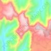
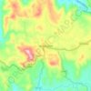
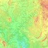
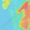
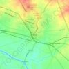
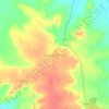
Ambad topographic map

Click on the map to display elevation.

Ambad

Ambad is located at 19°37′N 75°47′E / 19.62°N 75.79°E / 19.62; 75.79. It has an average elevation of 530 metres (1,740 ft).

Wikipedia (CC-BY-SA 3.0)

About this map

Name: Ambad topographic map, elevation, terrain.

Location: Ambad, Jalna, Maharashtra, India (19.35484 75.58538 19.77547 75.92929)

Average elevation: 1,558 ft

Minimum elevation: 1,345 ft

Maximum elevation: 2,162 ft

Other topographic maps

Click on a map to view its topography, its elevation and its terrain.
Pune

India > Maharashtra > Pune City Subdistrict

Average elevation: 2,103 ft

Vishalgad

India > Maharashtra > Shahuwadi

Average elevation: 1,667 ft

Maharashtra

India > Maharashtra

Maharashtra is the third largest state by area in India. The Western Ghats better known as Sahyadri, are a hilly range running parallel to the coast, at an average elevation of 1,200 metres (4,000 ft). Kalsubai, a peak in the Sahyadris, near Nashik city is the highest elevated point in Maharashtra. To the west…

Average elevation: 1,568 ft
Lohagad Fort

India > Maharashtra > Mawal > Malavli > Lohagadwadi

Average elevation: 2,612 ft

Ghatkopar Hill

India > Maharashtra > Mumbai

Average elevation: 164 ft

Sinhagad Fort

India > Maharashtra > Kalyan Gaon

Average elevation: 3,264 ft

Raigad Fort

India > Maharashtra > Mahad > Hirkaniwadi

Average elevation: 1,476 ft

Navi Mumbai

India > Maharashtra > Thane > Navi Mumbai

Navi Mumbai (Marathi pronunciation: , also known by its former name New Bombay), is a planned city off the west coast of the Indian state of Maharashtra in Konkan division. The city is divided into two parts, North Navi Mumbai and South Navi Mumbai, for the individual development of Panvel Mega City, which…

Average elevation: 98 ft
Amravati

India > Maharashtra > Amravati

Amravati is located at 20°56′N 77°45′E / 20.93°N 77.75°E / 20.93; 77.75. It has an average elevation of 343 meters (1125 feet). It lies 156 km (97 mi) west of Nagpur and serves as the administrative centre of Amravati District and of Amravati Division. The city is located near the passes…

Average elevation: 1,132 ft

Dategad

India > Maharashtra > Patan > Patan

Average elevation: 2,612 ft

Pune

India > Maharashtra > Pune City Subdistrict

Average elevation: 2,103 ft

Dombivli

India > Maharashtra > Kalyan Subdistrict > Kalyan-Dombivli

Dombivli is located at 19°13′06″N 73°05′12″E / 19.218433°N 73.086718°E / 19.218433; 73.086718. It has an average elevation of 13.534 meters (44.403 feet). The land here is rough and rocky by nature. The Ulhas river flows from its north.

Average elevation: 36 ft

Rohida Fort

India > Maharashtra > Bhor > Hathnoshi

Average elevation: 2,644 ft

Mandangad

India > Maharashtra > Mandangad Taluka

Average elevation: 702 ft

Panvel

India > Maharashtra > Panvel > Panvel

Matheran is a hill station and a municipal council in the Raigad district in the Indian state of Maharashtra. It is a hill station in Karjat Tahsil and is also the smallest hill station in India. It is located on the Western Ghats range at an elevation of around 800 m (2,625 feet) above sea level. It is…

Average elevation: 246 ft

Bavdhan Budruk

India > Maharashtra > Bavdhan Budruk

Average elevation: 2,051 ft

Pimpri-Chinchwad

India > Maharashtra > Haveli Subdistrict

Pimpri-Chinchwad also known as "PCMC", is a city in the Indian state of Maharashtra. The city is about 15 km (9.3 mi) northwest of the historic city of Pune, at an altitude of 590 m (1,940 ft) above sea level. It is the fifth largest city in Maharashtra and the nineteenth largest city in India and the…

Average elevation: 1,985 ft

Raireshwar Fort

India > Maharashtra > Bhor

Average elevation: 3,757 ft

Pratapgad

India > Maharashtra > Arjuni Morgaon Taluka

Average elevation: 896 ft

Tillari Dam

India > Maharashtra > Dodamarg Taluka

Average elevation: 295 ft

Natepute

India > Maharashtra > Malshiras

Average elevation: 1,755 ft

Rangana Fort

India > Maharashtra > Kudal Taluka > Gothos

Average elevation: 1,516 ft

Chandrapur

India > Maharashtra

Average elevation: 797 ft

Nashik

India > Maharashtra

Average elevation: 1,821 ft

Jalgaon

India > Maharashtra

Average elevation: 1,181 ft

Mhalunge

India > Maharashtra

Average elevation: 2,559 ft

Ahmadnagar

India > Maharashtra

Average elevation: 1,955 ft

Girna River

India > Maharashtra

Average elevation: 1,207 ft

Koyna River

India > Maharashtra

Average elevation: 1,135 ft

Dharavi

India > Maharashtra

Average elevation: 20 ft

Bhatsa

India > Maharashtra

Average elevation: 427 ft

Yelgaon Dam

India > Maharashtra

Average elevation: 2,005 ft

Kale

India > Maharashtra

Average elevation: 1,929 ft

Degma Bk

India > Maharashtra

Average elevation: 1,263 ft

Asoli

India > Maharashtra

Average elevation: 968 ft

Jivdhan

India > Maharashtra > Junnar > Ghatghar

Average elevation: 2,359 ft

Mumbai

India > Maharashtra

Mumbai lies at the mouth of the Ulhas River on the western coast of India, in the coastal region known as the Konkan. It sits on Salsette Island (Sashti Island), which it partially shares with the Thane district. Mumbai is bounded by the Arabian Sea to the west. Many parts of the city lie just above sea level,…

Average elevation: 43 ft
Gorai

India > Maharashtra

Average elevation: 16 ft

Mama Bhanja

India > Maharashtra > Thane Subdistrict > Thane

Average elevation: 581 ft

Devbag

India > Maharashtra > Malvan Taluka

Average elevation: 52 ft

Achra

India > Maharashtra > Malvan Taluka

Average elevation: 72 ft

Khopoli

India > Maharashtra > Khalapur Taluka

Average elevation: 732 ft

Shendra MIDC

India > Maharashtra > Shendra MIDC

Average elevation: 1,952 ft

Badlapur

India > Maharashtra > Badlapur

Average elevation: 138 ft

Revdanda Fort

India > Maharashtra > Alibag > Chaul

Average elevation: 16 ft

Panhala Fort

India > Maharashtra > Shahuwadi > Panhala

Average elevation: 2,707 ft

Ajinkyatara Fort

India > Maharashtra > Satara > Satara

Ajinkyatara Fort, also known as the "Fort of the Sapta-Rishi," is a historical hill fort located on Ajinkyatara Mountain, one of the seven mountains surrounding the city of Satara in the Sahyadri Mountains of Maharashtra, India. Situated at an altitude of 3,300 feet, the fort overlooks Satara City and is…

Average elevation: 2,507 ft
Sindhudurg Fort

India > Maharashtra > Malwan > Malvan

Average elevation: 3 ft

Kulaba Fort

India > Maharashtra > Alibag > Alibag

Average elevation: 3 ft

Varasgaon Dam

India > Maharashtra > Velhe > Kuran Budruk

Average elevation: 2,070 ft

Shivneri Fort

India > Maharashtra > Junnar > Junnar

Average elevation: 2,448 ft

Tikona Fort

India > Maharashtra > Mawal > Tikona Peth

Average elevation: 2,434 ft

Yeola

India > Maharashtra > Yeola Taluka

Average elevation: 1,834 ft

Purandar Fort

India > Maharashtra > Purandhar > Narayanpur

Average elevation: 3,369 ft

Malkhed

India > Maharashtra > Haveli

Average elevation: 2,067 ft

Indian subcontinent

India > Maharashtra > Arni

Average elevation: 1,155 ft

Tambha

India > Maharashtra > Deoli

Average elevation: 827 ft

Vengurla

India > Maharashtra > Vengurla Taluka

Vengurla is located at 15°52′N 73°38′E / 15.87°N 73.63°E / 15.87; 73.63. It has an average elevation of 11 metres (36 ft). Vengurla is also known as Vingoria. It includes areas such as Dabholi, Khanoli, Vetore, Tendoli, Wayangani, Surangpani, Shiroda, Redi.

Average elevation: 118 ft

Tarapur

India > Maharashtra > Palghar Taluka > Boisar

Average elevation: 52 ft

Lavasa

India > Maharashtra > Mulshi Subdistrict

Average elevation: 2,677 ft

Dombivali

India > Maharashtra > Kalyan Subdistrict

Average elevation: 39 ft

Ratangad

India > Maharashtra > Akola > Ratanwadi

Average elevation: 2,861 ft

Sarasbaug

India > Maharashtra > Pune City Subdistrict > Pune

Average elevation: 1,893 ft

Maan

India > Maharashtra > Mulshi Subdistrict

Average elevation: 1,939 ft

Mahar Thana

India > Maharashtra > Mulshi Subdistrict

Average elevation: 2,231 ft

Mama Bhanja

India > Maharashtra > Thane Subdistrict > Thane

Average elevation: 581 ft

Jambulmal

India > Maharashtra

Average elevation: 840 ft

Miraj

India > Maharashtra > Miraj

Average elevation: 1,821 ft

Nandgao Tanda

India > Maharashtra > Ambejogai

Average elevation: 2,126 ft

Bhawan

India > Maharashtra > Sillod

Average elevation: 1,955 ft

Bhudargad

India > Maharashtra > Gargoti > Thanewadi

Average elevation: 2,759 ft

Ane

India > Maharashtra > Junnar

Average elevation: 2,703 ft

Moula Ali

India > Maharashtra > Mukhed > Manjari

Average elevation: 1,486 ft

Malegaon Budruk

India > Maharashtra > Georai

Average elevation: 1,470 ft

Selgaon (umate)

India > Maharashtra > Karanja

Average elevation: 1,588 ft

Rajapur

India > Maharashtra > Rajapur Taluka

Average elevation: 440 ft

Dhalewadi

India > Maharashtra > Patoda

Average elevation: 2,441 ft

Sasura

India > Maharashtra > Kaij

Average elevation: 2,392 ft

Shirgaon

India > Maharashtra > Tasgaon

Average elevation: 1,949 ft

Parbhani

India > Maharashtra > Parbhani

Parbhani is located at 19°16′N 76°47′E / 19.27°N 76.78°E / 19.27; 76.78. It has an average elevation of 347 metres.

Average elevation: 1,348 ft
Alibag

India > Maharashtra > Alibag Taluka

Alibag is located about 120 km south of Mumbai, at 18°38′29″N 72°52′20″E / 18.64139°N 72.87222°E / 18.64139; 72.87222. The average elevation is 0 metres (0 feet).The District Government offices are located along the sea coast road. Alibag is the center place of Raigad District.

Average elevation: 39 ft
Solapur

India > Maharashtra > Solapur North

Solapur is located at 17°41′N 75°55′E / 17.68°N 75.92°E / 17.68; 75.92. It has an average elevation of 458 metres (1502 feet). It is bordered by Ahmednagar district on the north; Osmanabad district on the north and northeast.

Average elevation: 1,539 ft
Mahad

India > Maharashtra > Mahad Taluka

Several disasters like floods and landslides have continuously devastated markets and old houses, specifically classic Konkani-styled architecture, causing great loss of life. This is primarily due to lower elevation of the city compared to surrounding areas and being surrounded by rivers on all sides, making…

Average elevation: 246 ft

Pandharpur

India > Maharashtra > Pandharpur

Average elevation: 1,506 ft

Ramtek

India > Maharashtra > Ramtek

Average elevation: 1,056 ft

Saswad

India > Maharashtra > Purandhar

Average elevation: 2,582 ft

Rasayani

India > Maharashtra > Khalapur Taluka

Average elevation: 157 ft

Patnus

India > Maharashtra > Mangaon

Average elevation: 433 ft

korlai

India > Maharashtra > Murud Taluka > Korlai

Average elevation: 7 ft

Waifad

India > Maharashtra > Wardha

Average elevation: 922 ft

Ghatghar

India > Maharashtra > Junnar

Average elevation: 2,484 ft

Bhimashankar

India > Maharashtra > Khed

Average elevation: 2,457 ft

Ganeshgaon

India > Maharashtra > Malshiras

Average elevation: 1,585 ft

Naigaon Mayur WLS

India > Maharashtra > Patoda > Naigaon

Average elevation: 2,231 ft

Naigaon

India > Maharashtra > Patoda

Average elevation: 2,172 ft

Gear up for your next adventure:

🪑Ultralight Camp Chairs - Portable seating for resting after a long day of mapping
🧭Orienteering Set - Complete compass and map reading kit
🎒Outdoor Daypacks - Lightweight backpacks designed for carrying maps and essential gear
🧦Hiking Socks - Comfortable socks to prevent blisters on long hikes
🚗GPS Dash Cams - Record your scenic drives through mountain passes and canyons

As an Amazon Associate, this site earns from qualifying purchases at no extra cost to you.