

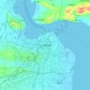
Trenggalek topographic map
Click on the map to display elevation.
About this map

Name: Trenggalek topographic map, elevation, terrain.
Location: Trenggalek, East Java, Indonesia (-8.40664 111.39211 -7.88838 111.84693)
Average elevation: 922 ft
Minimum elevation: -3 ft
Maximum elevation: 4,488 ft
Other topographic maps
Click on a map to view its topography, its elevation and its terrain.















Peternakan Kuda Mega Star Indonesia
Indonesia > East Java > Batu > Tlekung
Average elevation: 3,589 ft






Tegalpare
Indonesia > East Java > Banyuwangi > Desa Wringin Putih > Wringin Putih
Average elevation: 26 ft


King Kong Hill
Indonesia > East Java > Probolinggo > Cemorolawang > Kedaluh
Average elevation: 7,815 ft



Mount Bromo
Indonesia > East Java > Pasuruan
Further eruptions and the issuing of aviation ash advisories during the period 27–28 January 2011 led to concerns being raised regarding a volcanic ash plume, reported to be drifting eastward toward the air corridors used to access the Ngurah Rai International Airport IATA:DPS in Bali. Airport official…
Average elevation: 7,346 ft















Mount Penanggungan
Indonesia > East Java > Mojokerto > Kedungudi
There are sub-peaks around Penanggungan, starting to the southeast from Mount Wangi (Gunung Wangi) at 970 meters above sea level, Mount Bekel Jolotundo elevated 1,200 meters ASL, a semi-freestanding peak to the northwest; Puncak Kemuncup rising to 1,200 meters on the eastern face, Puncak Sarah Klopo on the…
Average elevation: 3,481 ft