
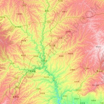
洛川县 topographic map
Interactive map
Click on the map to display elevation.
About this map
Name: 洛川县 topographic map, elevation, terrain.
Location: 洛川县, 延安市, 陕西省, 中国 (35.35145 109.30845 36.07702 109.76746)
Average elevation: 3,688 ft
Minimum elevation: 2,113 ft
Maximum elevation: 5,449 ft
洛川海拔约1000米左右,是著名的黄土塬区,黄土地貌发育典型,黑木沟辟有陕西洛川黄土国家地质公园。
Other topographic maps
Click on a map to view its topography, its elevation and its terrain.