
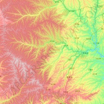
吴起县 topographic map
Interactive map
Click on the map to display elevation.
About this map
Name: 吴起县 topographic map, elevation, terrain.
Location: 吴起县, 延安市, 陕西省, 中国 (35.35250 108.51122 35.82451 109.45548)
Average elevation: 4,147 ft
Minimum elevation: 2,493 ft
Maximum elevation: 5,955 ft
黄陵县属鄂尔多斯台地的一部分,为黄土高原沟壑区。平均海拔1200米。属温带大陆型气候,年平均气温9.4度,无霜期172天,年平均降水568.8毫米。四季分明,光照充足,气候温和。
Other topographic maps
Click on a map to view its topography, its elevation and its terrain.