Geolocate

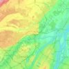
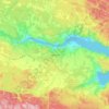
Outaouais topographic map

Click on the map to display elevation.

About this map

Name: Outaouais topographic map, elevation, terrain.

Location: Outaouais, Quebec, Canada (45.37238 -77.93161 47.84774 -74.69876)

Average elevation: 1,043 ft

Minimum elevation: 125 ft

Maximum elevation: 2,372 ft

Other topographic maps

Click on a map to view its topography, its elevation and its terrain.
Tee Lake

Canada > Quebec > Témiscamingue

Average elevation: 919 ft

Montagne des Érables

Canada > Quebec > Charlevoix-Est > Mont-Élie

Average elevation: 2,526 ft

Mount Royal

Canada > Quebec > Urban agglomeration of Montreal > Montreal

The hill is part of the Monteregian Hills situated between the Laurentians and the Appalachian Mountains. It gave its Latin name, Mons Regius, to the Monteregian chain. The hill consists of three peaks: Colline de la Croix (or Mont Royal proper) at 233 m (764 ft), Colline d'Outremont (or Mount Murray, in the…

Average elevation: 364 ft
Lac Bitobi

Canada > Quebec > Gracefield

Average elevation: 535 ft

Barrage Rhéaume

Canada > Quebec > Gatineau > Buckingham

Average elevation: 325 ft

Sunny Bank

Canada > Quebec > La Côte-de-Gaspé > Gaspé

Average elevation: 207 ft

Quebec

Canada > Quebec > Urban agglomeration of Québec

Quebec City was built on the north bank of the Saint Lawrence River, where it narrows and meets the mouth of the Saint-Charles River. Old Quebec is located on top and at the foot of Cap-Diamant, which is on the eastern edge of a plateau called the promontory of Quebec (Quebec hill). Because of this topographic…

Average elevation: 328 ft
Lac Supérieur

Canada > Quebec > Les Laurentides > Lac-Supérieur

Average elevation: 1,148 ft

Forêt Montmorency

Canada > Quebec > La Côte-de-Beaupré > Lac-Jacques-Cartier

Located in the Laurentian Mountains, the Montmorency forest is drained by the Montmorency River and by one of its tributaries, the Black river. There are four lakes: Lac Piché, Bédard, Laflamme and Joncas. The altitude varies between 600 and 1,000 meters (3,300 ft) with an average of 750 meters. The…

Average elevation: 2,605 ft
Pointe Décarie

Canada > Quebec > Les Laurentides > La Minerve

Average elevation: 1,076 ft

Manawan

Canada > Quebec

Average elevation: 1,493 ft

La Grande Rivière

Canada > Quebec

Average elevation: 1,604 ft

Lac-Simon

Canada > Quebec

Average elevation: 1,053 ft

Trois-Rivières

Canada > Quebec > Trois-Rivières

Average elevation: 125 ft

Île Papineau

Canada > Quebec > Antoine-Labelle > Mont-Laurier

Average elevation: 925 ft

Monts Otish

Canada > Quebec

Average elevation: 3,031 ft

Le Petit Cap

Canada > Quebec

Average elevation: 36 ft
Lac Clair

Canada > Quebec

Average elevation: 1,109 ft

Saint-Éleuthère

Canada > Quebec > Témiscouata

Average elevation: 971 ft

L'Île-Saint-Régis

Canada > Quebec

Average elevation: 161 ft

Mont Mégantic

Canada > Quebec > Le Haut-Saint-François > La Patrie

Average elevation: 2,927 ft

Saint-Joseph-de-Mékinac

Canada > Quebec > Mékinac > Trois-Rives

Average elevation: 538 ft

Val-Limoges

Canada > Quebec > Antoine-Labelle > Mont-Laurier

Average elevation: 948 ft

Chutes de la Chaudière

Canada > Quebec > Lévis

Average elevation: 187 ft

Baie Comeau

Canada > Quebec > Manicouagan > Baie-Comeau

Average elevation: 115 ft

Lac-à-la-Truite

Canada > Quebec > Les Appalaches > Adstock

Average elevation: 1,398 ft

Mont Shefford

Canada > Quebec > La Haute-Yamaska > Shefford

Average elevation: 1,010 ft

Lac Clark

Canada > Quebec > Pontiac (MRC) > Otter Lake

Average elevation: 771 ft

Cazaville

Canada > Quebec > Le Haut-Saint-Laurent

Average elevation: 190 ft

Mont Arthabaska

Canada > Quebec > Arthabaska > Victoriaville

Average elevation: 673 ft

Mont Orford

Canada > Quebec > Memphrémagog > Orford

Average elevation: 1,834 ft

Terrebonne

Canada > Quebec > Terrebonne > Terrebonne

Average elevation: 112 ft

Saguenay

Canada > Quebec > Ville de Saguenay

Average elevation: 492 ft

Gaspésie

Canada > Quebec > La Haute-Gaspésie > Mont-Albert

Average elevation: 1,506 ft

Joliette

Canada > Quebec > Joliette

Average elevation: 220 ft

Le Bout-de-l'Île

Canada > Quebec > Lac-Saint-Jean-Est > Alma

Average elevation: 341 ft

Lac du Podzol

Canada > Quebec > Manicouagan > Rivière-aux-Outardes

Average elevation: 1,762 ft

Lac Quenouille

Canada > Quebec > La Haute-Côte-Nord > Lac-au-Brochet

Average elevation: 1,617 ft

Roggan River

Canada > Quebec > Eeyou Istchee

Average elevation: 26 ft

Lac MacLeod

Canada > Quebec > Argenteuil > Harrington

Average elevation: 951 ft

Lac Chevreuil

Canada > Quebec > Le Fjord-du-Saguenay > Mont-Valin

Average elevation: 2,552 ft

Sand Bay

Canada > Quebec > Pontiac > Clarendon

Average elevation: 279 ft

Saint-Philippe-d'Argenteuil

Canada > Quebec > Argenteuil

Average elevation: 236 ft

Rollet

Canada > Quebec > Rouyn-Noranda

Average elevation: 906 ft

Lac Mooney

Canada > Quebec > Matawinie > Chertsey

Average elevation: 1,198 ft

Mont Comi

Canada > Quebec > La Mitis > Saint-Donat

Average elevation: 1,378 ft

Lac Windfall

Canada > Quebec > Jamésie > Eeyou Istchee James Bay

Average elevation: 1,335 ft

Lac Weller

Canada > Quebec > Portneuf (MRC) > Saint-Ubalde

Average elevation: 518 ft

Luskville

Canada > Quebec > Les Collines-de-l'Outaouais > Pontiac

Average elevation: 430 ft

Shawville

Canada > Quebec > Pontiac

Average elevation: 558 ft

Mont Boisjoli

Canada > Quebec > Memphrémagog > Hatley (Canton)

Average elevation: 876 ft

Lac Rueckwald

Canada > Quebec > Pontiac > Thorne

Average elevation: 732 ft

Lac Wentworth

Canada > Quebec > Les Pays-d'en-Haut > Wentworth-Nord

Average elevation: 1,125 ft

Chutes Lockbow

Canada > Quebec > Papineau > Chénéville

Average elevation: 751 ft

Pink Lake

Canada > Quebec > Gatineau

Average elevation: 502 ft

Lac Beauvais

Canada > Quebec > Les Laurentides > Val-Morin

Average elevation: 1,440 ft

Laurentian Mountains

Canada > Quebec > Portneuf > Rivière-à-Pierre

Average elevation: 1,066 ft

Marsboro

Canada > Quebec > Le Granit > Marston

Average elevation: 1,447 ft

La Mauricie National Park

Canada > Quebec > Shawinigan

Average elevation: 1,260 ft

Lac-Cayamant

Canada > Quebec > La Vallée-de-la-Gatineau > Cayamant

Average elevation: 732 ft

Lac Pomponne

Canada > Quebec > Pontiac > Lac-Nilgaut

Average elevation: 1,138 ft

Lac d'Ours

Canada > Quebec > Pontiac > Litchfield

Average elevation: 784 ft

Lac Doré

Canada > Quebec > Maria-Chapdelaine > Passes-Dangereuses

Average elevation: 1,001 ft

Lac Bernard

Canada > Quebec > Abitibi > Saint-Dominique-du-Rosaire

Average elevation: 1,010 ft

Rivière Chateauguay

Canada > Quebec > Châteauguay

Average elevation: 75 ft

Lac Bourque

Canada > Quebec > Manicouagan > Franquelin

Average elevation: 541 ft

Lac Gale

Canada > Quebec > Brome-Missisquoi > Bromont

Average elevation: 633 ft

Gear up for your next adventure:

🛶Inflatable Kayak - Portable kayak for rivers, lakes, and expeditions
🥾Women's Hiking Boots - Top-rated trail boots with ankle support and superior grip
🎁Geography Themed Gifts - Unique gift ideas for map lovers and geography enthusiasts
🧯Emergency Survival Kit - All‑in‑one survival essentials for the backcountry
🔥Fast-Boil Camping Stoves - Efficient cooking systems for quick trail meals

As an Amazon Associate, this site earns from qualifying purchases at no extra cost to you.