
翠华镇 topographic map
Interactive map
Click on the map to display elevation.
About this map
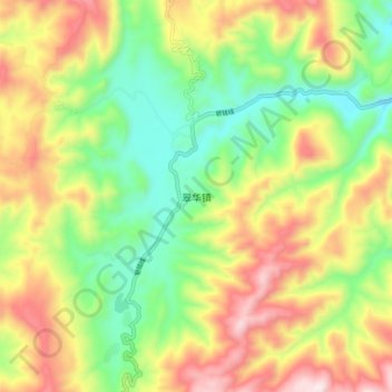
Name: 翠华镇 topographic map, elevation, terrain.
Location: 翠华镇, 昆明市, 云南省, 中国 (25.59158 102.54469 25.67158 102.62469)
Average elevation: 6,440 ft
Minimum elevation: 5,443 ft
Maximum elevation: 7,756 ft
Other topographic maps
Click on a map to view its topography, its elevation and its terrain.