
富民县 topographic map
Interactive map
Click on the map to display elevation.
About this map
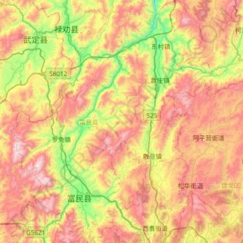
Name: 富民县 topographic map, elevation, terrain.
Location: 富民县, 昆明市, 云南省, 中国 (25.13307 102.34875 25.60922 102.78614)
Average elevation: 6,788 ft
Minimum elevation: 4,774 ft
Maximum elevation: 9,190 ft
Other topographic maps
Click on a map to view its topography, its elevation and its terrain.