
茨坝 topographic map
Interactive map
Click on the map to display elevation.
About this map
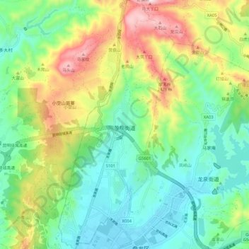
Name: 茨坝 topographic map, elevation, terrain.
Location: 茨坝, 盘龙区, 昆明市, 云南省, 中国 (25.11862 102.71631 25.21190 102.76431)
Average elevation: 6,949 ft
Minimum elevation: 6,230 ft
Maximum elevation: 8,422 ft
Other topographic maps
Click on a map to view its topography, its elevation and its terrain.