
滇源街道 topographic map
Interactive map
Click on the map to display elevation.
About this map
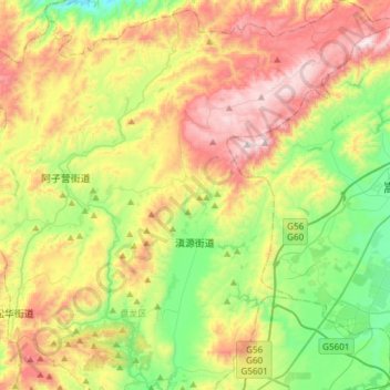
Name: 滇源街道 topographic map, elevation, terrain.
Location: 滇源街道, 盘龙区, 昆明市, 云南省, 中国 (25.19274 102.76338 25.46294 103.03503)
Average elevation: 7,251 ft
Minimum elevation: 5,866 ft
Maximum elevation: 9,222 ft
Other topographic maps
Click on a map to view its topography, its elevation and its terrain.