
科尔沁区 topographic map
Interactive map
Click on the map to display elevation.
About this map
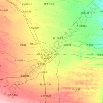
Name: 科尔沁区 topographic map, elevation, terrain.
Location: 科尔沁区, 通辽市, 内蒙古自治区, 028000, 中国 (43.36068 121.67612 43.95058 123.00449)
Average elevation: 610 ft
Minimum elevation: 476 ft
Maximum elevation: 833 ft
Other topographic maps
Click on a map to view its topography, its elevation and its terrain.