
科尔沁左翼中旗 topographic map
Interactive map
Click on the map to display elevation.
About this map
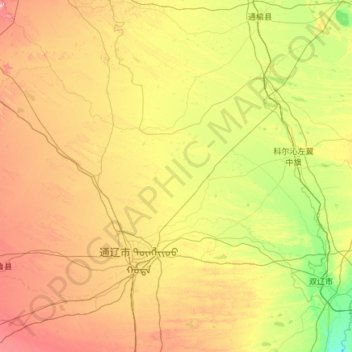
Name: 科尔沁左翼中旗 topographic map, elevation, terrain.
Location: 科尔沁左翼中旗, 通辽市, 内蒙古自治区, 中国 (43.54369 121.13846 44.50699 123.53252)
Average elevation: 574 ft
Minimum elevation: 325 ft
Maximum elevation: 1,168 ft
Other topographic maps
Click on a map to view its topography, its elevation and its terrain.