
鲁北镇 topographic map
Interactive map
Click on the map to display elevation.
About this map
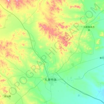
Name: 鲁北镇 topographic map, elevation, terrain.
Location: 鲁北镇, 扎鲁特旗, 通辽市, 内蒙古自治区, 中国 (44.44580 120.51788 44.89460 121.14872)
Average elevation: 1,204 ft
Minimum elevation: 686 ft
Maximum elevation: 2,785 ft
Other topographic maps
Click on a map to view its topography, its elevation and its terrain.