
奈曼旗 topographic map
Interactive map
Click on the map to display elevation.
About this map
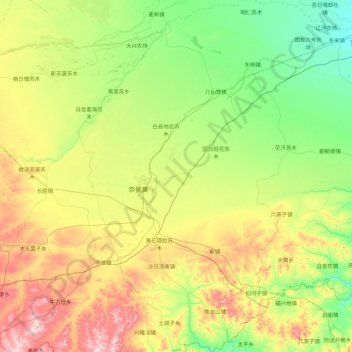
Name: 奈曼旗 topographic map, elevation, terrain.
Location: 奈曼旗, 通辽市, 内蒙古自治区, 中国 (42.24027 120.34205 43.54139 121.59888)
Average elevation: 1,204 ft
Minimum elevation: 692 ft
Maximum elevation: 2,618 ft
Other topographic maps
Click on a map to view its topography, its elevation and its terrain.