
Youngtown topographic map
Click on the map to display elevation.
About this map
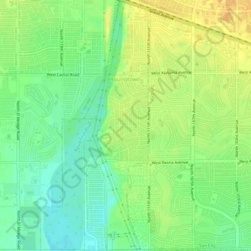
Name: Youngtown topographic map, elevation, terrain.
Location: Youngtown, Maricopa County, Arizona, 85363, United States (33.56536 -112.31156 33.60669 -112.29882)
Average elevation: 1,119 ft
Minimum elevation: 1,070 ft
Maximum elevation: 1,165 ft
Maricopa County trails, hiking, mountain biking, running and outdoor activities
Other topographic maps
Click on a map to view its topography, its elevation and its terrain.
Estrella Mountain Regional Park
United States > Arizona > Maricopa County > Avondale
Average elevation: 1,302 ft
Phoenix
United States > Arizona > Maricopa County > Phoenix
Phoenix is in the south-central portion of Arizona; about halfway between Tucson to the southeast and Flagstaff to the north, in the southwestern United States. By car, the city is approximately 150 miles (240 kilometers) north of the US–Mexico border at Sonoyta and 180 mi (290 km) north of the border at…
Average elevation: 1,207 ft
Sundad
United States > Arizona > Maricopa County
Sundad is an unincorporated area in the far west of Maricopa County, Arizona, United States, along the border of Yuma County. It has an estimated elevation of 965 feet (294 m) above sea level. It is located north of Agua Caliente and east of Sacation Flats.
Average elevation: 984 ft
Cave Creek Park - Thunderbird
United States > Arizona > Maricopa County > Phoenix
Average elevation: 1,316 ft
Pinnacle Peak
United States > Arizona > Maricopa County > Scottsdale
Pinnacle Peak is a granite summit located in Scottsdale, Arizona. The peak rises to an elevation of 3,169 feet (966 m). It is located within the 150-acre (61 ha) Pinnacle Peak Park, operated by the City of Scottsdale Park District. Part of the Sonoran Desert, the park is home to a variety of native desert…
Average elevation: 2,470 ft
Tempe
United States > Arizona > Maricopa County > Tempe
Tempe is generally flat, except for Hayden Butte (generally known as A-Mountain for Arizona State University's "A" logo located on its south face), located next to Sun Devil Stadium, Twin Buttes and Bell Butte on the western edge of Tempe, and Papago Park northwest of Tempe, inside Phoenix. Elevation ranges…
Average elevation: 1,266 ft
Salt River
United States > Arizona > Maricopa County > Scottsdale
Salt River is a populated place situated in Maricopa County, Arizona, United States. It has an estimated elevation of 1,220 feet (370 m) above sea level. It is located on the Salt River Pima–Maricopa Indian Community.
Average elevation: 1,220 ft
Desert Botanical Garden
United States > Arizona > Maricopa County > Phoenix
Average elevation: 1,276 ft
White Tank Mountain Regional Park
United States > Arizona > Maricopa County
Average elevation: 2,188 ft
Sentinel
United States > Arizona > Maricopa County
Sentinel is an unincorporated community in Maricopa County, Arizona, United States. It has an estimated elevation of 692 feet (211 m) above sea level.
Average elevation: 699 ft