
儋州市 topographic map
Interactive map
Click on the map to display elevation.
About this map
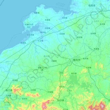
Name: 儋州市 topographic map, elevation, terrain.
Location: 儋州市, 海南省, 中国 (19.17503 108.92457 19.92760 109.76521)
Average elevation: 417 ft
Minimum elevation: -7 ft
Maximum elevation: 4,459 ft
Other topographic maps
Click on a map to view its topography, its elevation and its terrain.