
磊口乡 topographic map
Interactive map
Click on the map to display elevation.
About this map
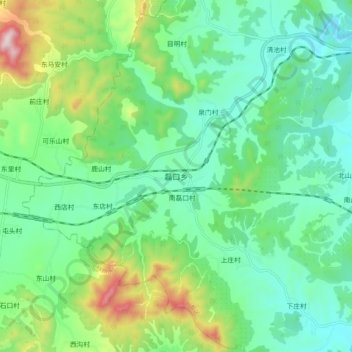
Name: 磊口乡 topographic map, elevation, terrain.
Location: 磊口乡, 殷都区, 安阳市, 河南省, 中国 (36.11440 113.95710 36.19440 114.03710)
Average elevation: 1,112 ft
Minimum elevation: 594 ft
Maximum elevation: 2,507 ft
Other topographic maps
Click on a map to view its topography, its elevation and its terrain.