
新野县 topographic map
Interactive map
Click on the map to display elevation.
About this map
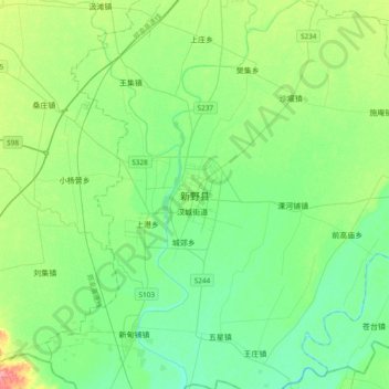
Name: 新野县 topographic map, elevation, terrain.
Location: 新野县, 南阳市, 河南省, 中国 (32.36575 112.20333 32.68575 112.52333)
Average elevation: 295 ft
Minimum elevation: 233 ft
Maximum elevation: 476 ft
Other topographic maps
Click on a map to view its topography, its elevation and its terrain.