
Kendall County topographic map
Click on the map to display elevation.
Kendall County
Kendall County is a small but rapidly growing county that has the majority of its population in the northeast, and along the Fox River (the only river in the county), which runs through the county's northwestern section. Many new subdivisions have been constructed in this county, which has produced considerable population growth. Southern Kendall still remains largely agricultural. Kendall County has two primary ranges of low-lying hills formed by what is known as an end moraine. Ransom, the more predominant of the two moraines, runs through the west and north-central part of the county. This moraine has created elevations over 800 feet (240 m), in contrast to elevations in southern Kendall County that drop to the lower 500-foot (150 m) range. Minooka, the other major end moraine ridge in Kendall County, runs along its entire eastern border with Will County. The two moraines intersect at almost a right angle in the township of Oswego. The county's only designated state park is Silver Springs State Fish and Wildlife Area.
About this map
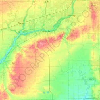
Name: Kendall County topographic map, elevation, terrain.
Location: Kendall County, Illinois, United States (41.45714 -88.60371 41.72466 -88.25218)
Average elevation: 656 ft
Minimum elevation: 545 ft
Maximum elevation: 810 ft
Illinois trails, hiking, mountain biking, running and outdoor activities
Other topographic maps
Click on a map to view its topography, its elevation and its terrain.
Illinois Beach State Park
United States > Illinois > Lake County
The park is located in the 12 mile long Zion Beach Ridge Plain. The Zion Beach Ridge Plain is 3,700 years old and composed of curvilinear ridge-and-swale topography. The beach ridges support black oak savanna habitat, while wetlands dominate the swales. The Zion Beach Ridge Plain has been migrating south…
Average elevation: 584 ft
Elmhurst
United States > Illinois > DuPage County
Due to local topography, the town has had a tendency to flood in the past after large rainfalls; the city is currently undertaking a large effort to mitigate future flooding.
Average elevation: 679 ft
North Pond Nature Sanctuary
United States > Illinois > Cook County > Chicago
Average elevation: 597 ft
Middle Fork State Fish and Wildlife Area
United States > Illinois > Vermilion County
Average elevation: 676 ft
Rock Cut State Park
United States > Illinois > Winnebago County > Machesney Park
Average elevation: 869 ft
Lowest Point in Illinois
United States > Illinois > Alexander County > Cairo
Average elevation: 305 ft
Piney Creek Ravine Nature Preserve
United States > Illinois > Randolph County
Average elevation: 548 ft
Hinsdale
United States > Illinois > Hinsdale
Hinsdale is a village in Cook and DuPage counties in the U.S. state of Illinois. Hinsdale is a western suburb of Chicago. The population was 16,816 at the 2010 census, most of whom lived in DuPage County. The town's ZIP code is 60521, which is listed in the top 1% of wealthiest towns in Illinois as well as the…
Average elevation: 702 ft
Little Grand Canyon
United States > Illinois > Jackson County
Erosion carved this deep box canyon from the sandstone of the Shawnee Hills, opening into the floodplain of the Mississippi River near Turkey Bayou. The canyon contains several seasonal and a few permanent waterfalls, some descending through dramatic cascades of sculpted sandstone. The 3.6-mile (5.8 km) trail…
Average elevation: 551 ft
Chicago, North Shore & Milwaukee
United States > Illinois > Cook County > Northbrook > Williamsburg Square
Average elevation: 650 ft
Riley
United States > Illinois > McHenry County
Riley, elevation 807 feet (246 m), is an unincorporated community and census-designated place in McHenry County, Illinois, United States. It was named a CDP before the 2020 census, at which time it had a population of 10.
Average elevation: 820 ft