
Portage la Prairie topographic map
Click on the map to display elevation.
About this map
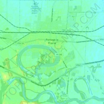
Name: Portage la Prairie topographic map, elevation, terrain.
Location: Portage la Prairie, Manitoba, Canada (49.93496 -98.33875 49.99696 -98.24579)
Average elevation: 860 ft
Minimum elevation: 840 ft
Maximum elevation: 896 ft
Other topographic maps
Click on a map to view its topography, its elevation and its terrain.
Lockport
Canada > Manitoba > Division No. 13 > Rural Municipality of St. Andrews
Average elevation: 761 ft
Red River Floodway
Canada > Manitoba > Rural Municipality of Springfield > Winnipeg
Average elevation: 774 ft
Little Saskatchewan First Nation
Canada > Manitoba > Little Saskatchewan First Nation
Average elevation: 810 ft
North Thomas Lake
Canada > Manitoba > Division No. 15 > Rural Municipality of Yellowhead
Average elevation: 1,955 ft
Hecla
Canada > Manitoba > Division No. 18 > Unorganized Division No. 18 (East)
Average elevation: 722 ft
Clear Lake
Canada > Manitoba > Division No. 18 > Rural Municipality of Grahamdale
Average elevation: 823 ft
Easterville
Canada > Manitoba > Division No. 21 > Unorganized Division No. 21
Average elevation: 853 ft
Riding Mountain National Park
The climate in the Riding Mountain region is similar to that of other regions of southwestern Manitoba. Under the Köppen classification it has a continental climate. It includes grasslands, upland boreal and eastern deciduous forest ecosystems. The park has hot summers and cold winters, with annual rainfall…
Average elevation: 1,601 ft
Rowland Lake
Canada > Manitoba > Division No. 15 > Rural Municipality of Rosedale
Average elevation: 2,270 ft
Bakers Narrows
Canada > Manitoba > Division No. 21 > Unorganized Division No. 21
Average elevation: 974 ft
Elphinstone
Canada > Manitoba > Division No. 15 > Rural Municipality of Yellowhead
Average elevation: 1,913 ft
West Hawk Lake
Canada > Manitoba > Division No. 1 > Unorganized Division No. 1
Average elevation: 1,145 ft