
Seven Gelding Tank topographic map
Click on the map to display elevation.
About this map
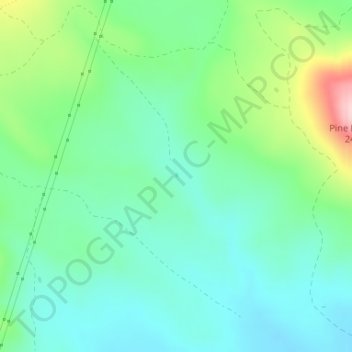
Name: Seven Gelding Tank topographic map, elevation, terrain.
Average elevation: 7,398 ft
Minimum elevation: 7,205 ft
Maximum elevation: 7,913 ft
Arizona trails, hiking, mountain biking, running and outdoor activities
Other topographic maps
Click on a map to view its topography, its elevation and its terrain.
Tucson
United States > Arizona > Pima County > Tucson
The city's elevation is 2,643 ft (806 m) above sea level (as measured at the Tucson International Airport). Tucson is on an alluvial plain in the Sonoran Desert, surrounded by five minor ranges of mountains: the Santa Catalina Mountains and the Tortolita Mountains to the north, the Santa Rita Mountains to the…
Average elevation: 2,743 ft
Kingman
United States > Arizona > Mohave County > Kingman
Lt. Edward Fitzgerald Beale, a U.S. Navy officer in the service of the U.S. Army Corps of Topographical Engineers, was ordered by the U.S. War Department to build a federal wagon road across the 35th Parallel. His secondary orders were to test the feasibility of the use of camels as pack animals in the…
Average elevation: 3,711 ft
Pinetop-Lakeside
United States > Arizona > Navajo County
Pinetop-Lakeside is nestled in the stunning White Mountains of northeastern Arizona, characterized by a varied topography that significantly influences its natural beauty and recreational opportunities. The terrain features elevations averaging around 6,795 feet, with rugged mountain landscapes interspersed…
Average elevation: 6,847 ft
Flagstaff
United States > Arizona > Coconino County
Flagstaff is the county seat of Coconino County. According to the United States Census Bureau, the city has a total area of 63.9 square miles (165.5 km2), of which only 0.03 square miles (0.08 km2) (0.08%) is water. Flagstaff lies at approximately 7,000 feet (2,130 m) elevation, and is surrounded by the…
Average elevation: 7,316 ft
Bullhead City
United States > Arizona > Mohave County > Bullhead City > Bullhead City
Average elevation: 804 ft
Coconino National Forest
The Coconino National Forest is a 1.856-million acre (751,000 ha) United States National Forest located in northern Arizona in the vicinity of Flagstaff, with elevations ranging from 2,600 feet to the highest point in Arizona at 12,633 feet (Humphrey's Peak). Originally established in 1898 as the "San…
Average elevation: 5,928 ft
Black Canyon City
United States > Arizona > Yavapai County
Black Canyon City is located at 34°4′11″N 112°8′22″W / 34.06972°N 112.13944°W / 34.06972; -112.13944 (34.069719, -112.139466), at an elevation of 1,975 feet (602 m).
Average elevation: 2,297 ft
Seligman
United States > Arizona > Yavapai County > Seligman
Seligman is located at 35°19′42″N 112°52′27″W / 35.32833°N 112.87417°W / 35.32833; -112.87417 (35.328199, −112.874303), at 5,240 feet (1,600 m) in elevation, alongside the Big Chino Wash, in a northern section of Chino Valley. The wash is a major tributary of the Verde River. Seligman is…
Average elevation: 5,305 ft
Alpine
United States > Arizona > Apache County
Located approximately 75 miles south of the Navajo Nation, Alpine was settled in 1876 by Anderson Bush, a European-American who built a log house there. He originally used it as a trading post known as "Fort Bush". Bush sold his holdings in 1879 to William Maxwell and Fred Hamblin, Mormon settlers who…
Average elevation: 8,235 ft
Sundad
United States > Arizona > Maricopa County
Sundad is an unincorporated area in the far west of Maricopa County, Arizona, United States, along the border of Yuma County. It has an estimated elevation of 965 feet (294 m) above sea level. It is located north of Agua Caliente and east of Sacation Flats.
Average elevation: 984 ft
McNary
United States > Arizona > Apache County
At an elevation of 7,316 feet (2,230 m), it is the second highest community in Arizona after Alpine.
Average elevation: 7,310 ft
Drexel Heights
United States > Arizona > Pima County > Tucson
The area has numerous Saguaro cacti, and is positioned only a couple of miles south of the Saguaro National Park. The northern boundary of Drexel Heights is the Tucson Mountain Park. It is cut off from the rest of Tucson due to the topography of the Tucson Mountains, which are only crossed via a small number…
Average elevation: 2,579 ft
San Manuel
United States > Arizona > Pinal County
San Manuel is located at 32°36′18″N 110°38′0″W / 32.60500°N 110.63333°W / 32.60500; -110.63333 (32.605048, -110.633340), in the San Pedro River Valley at an elevation of about 3,500 feet (1,100 m). San Manuel is approximately 45 miles (72 km) northeast of Tucson.
Average elevation: 3,251 ft