Geolocate

Acton topographic map

Interactive map

Click on the map to display elevation.

About this map

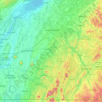
Name: Acton topographic map, elevation, terrain.

Location: Acton, Montérégie, Quebec, Canada (44.98006 -73.16023 46.26006 -71.88023)

Average elevation: 495 ft

Minimum elevation: 3 ft

Maximum elevation: 3,045 ft

Other topographic maps

Click on a map to view its topography, its elevation and its terrain.

Lac des Îles

Canada > Quebec > Rouyn-Noranda

Average elevation: 1,289 ft

Lac Grand

Canada > Quebec > La Côte-de-Beaupré > Lac-Jacques-Cartier

Average elevation: 1,854 ft

Saint-Zacharie

Canada > Quebec > Les Etchemins

Average elevation: 1,490 ft

Amos

Canada > Quebec > Abitibi

Average elevation: 1,027 ft

Milan

Canada > Quebec > Le Granit

Average elevation: 1,598 ft

Lac Nick

Canada > Quebec > Memphrémagog > Bolton-Est

Average elevation: 919 ft

Cap-Santé

Canada > Quebec > Portneuf (MRC)

Average elevation: 161 ft

Lac Caya

Canada > Quebec > La Vallée-de-la-Gatineau > Bouchette

Average elevation: 653 ft

Lac-des-Plages

Canada > Quebec > Papineau

Average elevation: 935 ft

Cayamant

Canada > Quebec > La Vallée-de-la-Gatineau

Average elevation: 814 ft

Entrelacs

Canada > Quebec > Matawinie

Average elevation: 1,411 ft

Lac Levesque

Canada > Quebec > Les Laurentides > Lac-Supérieur

Average elevation: 1,194 ft

Saint-Malo

Canada > Quebec > Coaticook (MRC)

Saint-Malo (local pronunciation) is a municipality in Quebec, Canada, on the Canada–United States border. Saint-Malo has the highest elevation of any municipality in Quebec. At 640 metres (2,100 ft), local residents live in an environment of forests, farms, and waterways that supply their livelihood.

Average elevation: 1,588 ft

Pierreville

Canada > Quebec > Nicolet-Yamaska

Average elevation: 52 ft

Saint-Michel-des-Saints

Canada > Quebec > Matawinie

Average elevation: 1,496 ft

Lac Clair

Canada > Quebec > Matawinie > Rawdon

Average elevation: 1,070 ft

Beauce

Canada > Quebec > Beauce-Sartigan

Average elevation: 1,237 ft

Crabtree

Canada > Quebec > Joliette (MRC)

Average elevation: 151 ft

Trois-Rivières

Canada > Quebec

Average elevation: 118 ft

Litchfield

Canada > Quebec > Pontiac

Average elevation: 571 ft

Maria

Canada > Quebec > Avignon

Average elevation: 338 ft

Mont-Joli

Canada > Quebec > La Mitis

Average elevation: 207 ft

Lac Maria

Canada > Quebec > La Côte-de-Beaupré > Lac-Jacques-Cartier

Average elevation: 2,477 ft

Black and White

Canada > Quebec > Les Laurentides > Montcalm

Average elevation: 974 ft

Anticosti Island

Canada > Quebec

Topographically, Anticosti Island can be divided into three distinct regions: two lowland areas, rarely exceeding 150 metres (490 ft) in elevation, in the eastern and western thirds of the island linked along the coast; and a central highland forming a plateau that rises to just over 300 m (980 ft). This…

Average elevation: 98 ft

Saint-Félicien

Canada > Quebec > Le Domaine-du-Roy

Average elevation: 463 ft

Kamouraska (MRC)

Canada > Quebec

Average elevation: 820 ft

Acton

Canada > Quebec

Average elevation: 433 ft

Notre-Dame-de-Lourdes

Canada > Quebec > Joliette (MRC)

Average elevation: 259 ft

Val-d'Or

Canada > Quebec > La Vallée-de-l'Or

Val-d'Or is situated on the Canadian Shield at an elevation of 1100 feet (330m) above sea level. Although its name refers to a valley ("Val"), the city is actually situated on a vast, slightly undulating plain.

Average elevation: 1,086 ft

Sainte-Rose-de-Watford

Canada > Quebec > Les Etchemins

Average elevation: 1,214 ft

Brigham

Canada > Quebec > Brome-Missisquoi

Average elevation: 315 ft

Brome-Missisquoi

Canada > Quebec

Average elevation: 597 ft

Sainte-Françoise

Canada > Quebec > Bécancour (MRC)

Average elevation: 289 ft

Sainte-Luce

Canada > Quebec > La Mitis

Average elevation: 125 ft

Saint Lawrence River

Canada > Quebec > Montreal

Average elevation: 46 ft

Shawville

Canada > Quebec > Pontiac

Average elevation: 561 ft

Lac-Beauport

Canada > Quebec > La Jacques-Cartier

Average elevation: 1,161 ft

Chartierville

Canada > Quebec > Le Haut-Saint-François

Average elevation: 1,939 ft

Otter Lake

Canada > Quebec > Pontiac

Average elevation: 860 ft

Lacs Roger

Canada > Quebec > Maria-Chapdelaine > Passes-Dangereuses

Average elevation: 1,253 ft

Saint-Sauveur

Canada > Quebec > Les Pays-d'en-Haut

Average elevation: 965 ft

Capitale-Nationale

Canada > Quebec

Average elevation: 1,230 ft

Lac Maton

Canada > Quebec > La Vallée-de-la-Gatineau > Lac-Pythonga

Average elevation: 1,302 ft

René-Levasseur Island

Canada > Quebec > Manicouagan

Average elevation: 1,555 ft

Wickham

Canada > Quebec > Drummond

Average elevation: 341 ft

Rosemère

Canada > Quebec > Thérèse-De Blainville

Average elevation: 121 ft

Hudson

Canada > Quebec > Vaudreuil-Soulanges

Average elevation: 184 ft

Gaspé Peninsula

Canada > Quebec

Average elevation: 623 ft

Lac Emro

Canada > Quebec > Pontiac > Lac-Nilgaut

Average elevation: 1,020 ft

Lac Genève

Canada > Quebec > Jamésie

Average elevation: 1,348 ft

Rawdon

Canada > Quebec > Matawinie

Average elevation: 646 ft

Saint-Janvier-de-Joly

Canada > Quebec > Lotbinière (MRC)

Average elevation: 384 ft

Chapais

Canada > Quebec > Jamésie

Average elevation: 1,257 ft

Lac Forant

Canada > Quebec > Pontiac > Lac-Nilgaut

Average elevation: 935 ft

Lac-Jacques-Cartier

Canada > Quebec > La Côte-de-Beaupré

Average elevation: 2,333 ft

Low

Canada > Quebec > La Vallée-de-la-Gatineau

Average elevation: 722 ft

Saguenay

Canada > Quebec

Average elevation: 850 ft

Big Black River

Canada > Quebec > L'Islet (MRC) > Saint-Marcel

Average elevation: 1,260 ft

Bas-Saint-Laurent

Canada > Quebec

The topography of Bas-Saint-Laurent has two main elements : the plateaus of the Appalachian Mountains, called Notre Dame Mountains, and the lowlands in the fine stripe of land along the Saint Lawrence river. These are separated by an intermediate area of ridges and foothills which meld with the plateaus. The…

Average elevation: 935 ft

Lac-Brome

Canada > Quebec > Brome-Missisquoi

Average elevation: 866 ft

Pingualuit Crater

Canada > Quebec > Kativik > Rivière-Koksoak

Average elevation: 1,765 ft

Eeyou Istchee James Bay

Canada > Quebec > Jamésie

Average elevation: 761 ft

La Pêche

Canada > Quebec > Les Collines-de-l'Outaouais

Average elevation: 702 ft

Yamachiche

Canada > Quebec > Maskinongé (MRC)

Average elevation: 72 ft

Hull

Canada > Quebec > Gatineau

Average elevation: 226 ft

Piedmont

Canada > Quebec > Les Pays-d'en-Haut

Average elevation: 833 ft

Lac Dumont

Canada > Quebec > Charlevoix-Est > Baie-Sainte-Catherine

Average elevation: 499 ft

Saint-Barthélemy

Canada > Quebec > D'Autray

Average elevation: 197 ft

Mascouche

Canada > Quebec > Les Moulins

Average elevation: 118 ft

Mont-Albert

Canada > Quebec > La Haute-Gaspésie

The ghost town of Saint-Octave-de-l'Avenir is about 18 kilometres (11 mi) south-southeast of Cap-Chat, at an altitude of 380 metres (1,250 ft). It was formed in 1932 as part of the Vautrin Settlement Plan to encourage colonization of Gaspésie's interior and intended to bring relief during the Great Depression…

Average elevation: 1,401 ft

Cacouna

Canada > Quebec > Cacouna

Average elevation: 89 ft

Sainte-Adèle

Canada > Quebec > Les Pays-d'en-Haut

Average elevation: 1,102 ft

Saint-Bernard

Canada > Quebec > La Nouvelle-Beauce

Average elevation: 604 ft

Les Escoumins

Canada > Quebec > La Haute-Côte-Nord

Average elevation: 354 ft

Pointe-Calumet

Canada > Quebec > Deux-Montagnes

Average elevation: 82 ft

Shefford

Canada > Quebec > La Haute-Yamaska

Average elevation: 692 ft

Bécancour

Canada > Quebec > Bécancour (MRC)

Average elevation: 128 ft

Kuujjuaq (Village)

Canada > Quebec > Kativik

Average elevation: 210 ft

Ormstown

Canada > Quebec > Le Haut-Saint-Laurent > Ormstown

Average elevation: 207 ft

Lac-Supérieur

Canada > Quebec > Les Laurentides

Average elevation: 1,503 ft

Lac Français

Canada > Quebec > Shawinigan

Average elevation: 755 ft