
Farmborough topographic map
Click on the map to display elevation.
Exploring new terrains?
Equip yourself with the best gear to stay comfortable and safe:
As an Amazon Associate, this site earns from qualifying purchases at no extra cost to you.
About this map
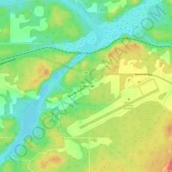
Name: Farmborough topographic map, elevation, terrain.
Average elevation: 951 ft
Minimum elevation: 863 ft
Maximum elevation: 1,030 ft
Other topographic maps
Click on a map to view its topography, its elevation and its terrain.
Notre Dame Island
Canada > Quebec > Urban agglomeration of Montreal > Montreal
Average elevation: 46 ft
Saint-Malo
Canada > Quebec > Coaticook (MRC)
Saint-Malo (local pronunciation) is a municipality in Quebec, Canada, on the Canada–United States border. Saint-Malo has the highest elevation of any municipality in Quebec. At 640 metres (2,100 ft), local residents live in an environment of forests, farms, and waterways that supply their livelihood.
Average elevation: 1,588 ft
Val-d'Or
Canada > Quebec > La Vallée-de-l'Or
Val-d'Or is situated on the Canadian Shield at an elevation of 1100 feet (330m) above sea level. Although its name refers to a valley ("Val"), the city is actually situated on a vast, slightly undulating plain.
Average elevation: 1,086 ft
Ayers Cliff Exposition Grounds
Canada > Quebec > Memphrémagog > Ayer's Cliff
Average elevation: 571 ft
Île d'Entrée
Canada > Quebec > Urban agglomeration of Les Îles-de-la-Madeleine > Les Îles-de-la-Madeleine > L'Île-d'Entrée
Average elevation: 66 ft
Galerie d'amenée d'eau, Manic-5
Canada > Quebec > Manicouagan > Rivière-aux-Outardes
Average elevation: 1,112 ft
Saint-Louis-de-Gonzague-du-Cap-Tourmente
Canada > Quebec > La Côte-de-Beaupré
Average elevation: 30 ft
Bas-Saint-Laurent
The topography of Bas-Saint-Laurent has two main elements : the plateaus of the Appalachian Mountains, called Notre Dame Mountains, and the lowlands in the fine stripe of land along the Saint Lawrence river. These are separated by an intermediate area of ridges and foothills which meld with the plateaus. The…
Average elevation: 935 ft
Lac de la Carpe
Canada > Quebec > Urban agglomeration of La Tuque > La Tuque
Average elevation: 1,293 ft
Parc Marie-Claire-Kirkland-Casgrain
Canada > Quebec > Urban agglomeration of Montreal > Montreal
Average elevation: 79 ft
Mont-Albert
Canada > Quebec > La Haute-Gaspésie
The ghost town of Saint-Octave-de-l'Avenir is about 18 kilometres (11 mi) south-southeast of Cap-Chat, at an altitude of 380 metres (1,250 ft). It was formed in 1932 as part of the Vautrin Settlement Plan to encourage colonization of Gaspésie's interior and intended to bring relief during the Great Depression…
Average elevation: 1,401 ft
Waltham
Canada > Quebec > Pontiac (MRC) > Waltham
Its territory, with a maximum elevation of just over 350 metres (1,150 ft), is sparsely populated, the majority of the population living along or near the Ottawa River. The northern portion is a vast extended tract of undeveloped land, dotted with lakes, such as Findlay, Landon, Gagnon, and Caughlin, which are…
Average elevation: 804 ft
Bras Saint-Victor
Canada > Quebec > Beauce-Centre > Saint-Victor > Saint-Victor-Station
Average elevation: 1,053 ft
Saint-Faustin–Lac-Carré
Canada > Quebec > Les Laurentides > Saint-Faustin–Lac-Carré
Average elevation: 1,302 ft