
雄村镇 topographic map
Interactive map
Click on the map to display elevation.
About this map
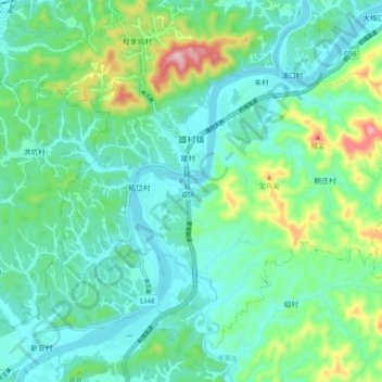
Name: 雄村镇 topographic map, elevation, terrain.
Location: 雄村镇, 歙县, 黄山市, 安徽省, 中国 (29.77372 118.40219 29.84724 118.50030)
Average elevation: 558 ft
Minimum elevation: 322 ft
Maximum elevation: 1,339 ft
Other topographic maps
Click on a map to view its topography, its elevation and its terrain.