
坑口乡 topographic map
Interactive map
Click on the map to display elevation.
About this map
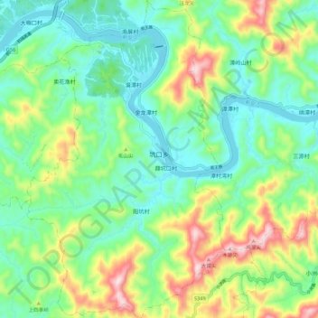
Name: 坑口乡 topographic map, elevation, terrain.
Location: 坑口乡, 歙县, 黄山市, 安徽省, 中国 (29.76200 118.48200 29.85571 118.54938)
Average elevation: 787 ft
Minimum elevation: 312 ft
Maximum elevation: 1,841 ft
Other topographic maps
Click on a map to view its topography, its elevation and its terrain.