
许村镇 topographic map
Interactive map
Click on the map to display elevation.
About this map
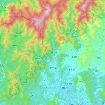
Name: 许村镇 topographic map, elevation, terrain.
Location: 许村镇, 歙县, 黄山市, 安徽省, 中国 (29.93272 118.26278 30.11054 118.34737)
Average elevation: 1,624 ft
Minimum elevation: 436 ft
Maximum elevation: 4,521 ft
Other topographic maps
Click on a map to view its topography, its elevation and its terrain.