
岔口镇 topographic map
Interactive map
Click on the map to display elevation.
About this map
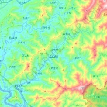
Name: 岔口镇 topographic map, elevation, terrain.
Location: 岔口镇, 歙县, 黄山市, 安徽省, 中国 (29.84457 118.68190 29.93756 118.84197)
Average elevation: 1,188 ft
Minimum elevation: 322 ft
Maximum elevation: 3,333 ft
Other topographic maps
Click on a map to view its topography, its elevation and its terrain.