Geolocate

Saba topographic map

Interactive map

Click on the map to display elevation.

About this map

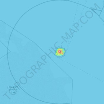
Name: Saba topographic map, elevation, terrain.

Location: Saba, Netherlands (17.41400 -63.46882 17.85000 -63.02603)

Average elevation: 7 ft

Minimum elevation: 0 ft

Maximum elevation: 2,736 ft

There is an 8.6 hectares (21 acres) cloud forest located at and above 825 metres (2,707 ft) on top of the mountain referred to as the "Elfin Forest Reserve" because of its high altitude mist and mossy appearance. The most dominant tree in the cloud forest is the Mountain Mahogany (Freziera undulate), although hurricanes over the years have destroyed a large number of the mature trees. Despite the name, the mountain mahogany is not related to other mahogany species; although one species of true mahogany tree is found on the island at lower levels, the small-leaved mahogany (Swietenia mahagoni). In the underbrush of the mahogany trees, the Sierran palm (Prestoea montana) and tree ferns dominate, with a large variety of epiphytes and Orchids growing on the trunks and branches of all the trees. Wild raspberries and plantain trees can also be found growing on most of the mountain. All seven of the Lesser Antilles Endemic Bird Area restricted-range birds occur in the Elfin Forest Reserve.

Wikipedia (CC-BY-SA 3.0)

Other topographic maps

Click on a map to view its topography, its elevation and its terrain.

Amsterdam

Netherlands > North Holland

Amsterdam, North Holland, Netherlands

Average elevation: 0 ft

Curacao

Netherlands

Curacao, Netherlands

Average elevation: 7 ft

Holland

Netherlands

Holland, Netherlands

Average elevation: 7 ft

Zeeland

Netherlands

Zeeland, Netherlands

Average elevation: 3 ft

Utrecht

Netherlands > Utrecht

Utrecht, Netherlands

Average elevation: 10 ft

Geldrop

Netherlands > North Brabant

Geldrop, Geldrop-Mierlo, North Brabant, Netherlands

Average elevation: 69 ft

Aruba

Netherlands > Santa Cruz

Aruba, Santa Cruz, Aruba, ARUBA, Netherlands

Average elevation: 3 ft

Renswoude

Netherlands > Utrecht

Renswoude, Utrecht, Netherlands

Average elevation: 26 ft

Koudekerke

Netherlands > Zeeland

Koudekerke, Veere, Zeeland, Netherlands

Average elevation: 0 ft

Overberg

Netherlands > Utrecht

Overberg, Utrechtse Heuvelrug, Utrecht, Netherlands

Average elevation: 56 ft

Didam

Netherlands > Gelderland

Didam, Montferland, Gelderland, Netherlands

Average elevation: 39 ft

Scheemda

Netherlands > Groningen

Scheemda, Oldambt, Groningen, Netherlands

Average elevation: 0 ft

Veluwe

Netherlands > Gelderland

Veluwe, Gelderland, Netherlands

Average elevation: 59 ft

Veendam

Netherlands > Groningen

Veendam, Groningen, Netherlands

Average elevation: 10 ft

Zwanenburg

Netherlands > North Holland

Zwanenburg, Haarlemmermeer, North Holland, Netherlands

Average elevation: -10 ft

Cottessen

Netherlands > Limburg > Vijlen

Cottessen, Vijlen, Vaals, Limburg, Netherlands, 6294 NE, Netherlands

Average elevation: 600 ft

Kessel

Netherlands > Limburg

Kessel, Peel en Maas, Limburg, Netherlands

Average elevation: 89 ft

Overheek

Netherlands > Limburg > Termaar

Overheek, Termaar, Klimmen, Voerendaal, Limburg, Netherlands, 6343 DB, Netherlands

Average elevation: 387 ft

America

Netherlands > Limburg

America, Horst aan de Maas, Limburg, Netherlands

Average elevation: 102 ft

Berkhoek

Netherlands > North Brabant > Udenhout

Berkhoek, Udenhout, Tilburg, North Brabant, Netherlands, 5071 NE, Netherlands

Average elevation: 36 ft

Eemshaven

Netherlands > Groningen

Eemshaven, Het Hogeland, Groningen, Netherlands

Average elevation: 0 ft

Volendam

Netherlands > North Holland

Volendam, Edam-Volendam, North Holland, Netherlands

Average elevation: 0 ft

Leiden

Netherlands > South Holland

Leiden, South Holland, Netherlands

Average elevation: 3 ft

Leiden

Netherlands > South Holland

Leiden, South Holland, Netherlands

Average elevation: 3 ft

Flevoland

Netherlands

Flevoland, Netherlands

Average elevation: 3 ft

Ameland

Netherlands > Frisia

Ameland, Frisia, Netherlands

Average elevation: 0 ft

Wageningen

Netherlands > Gelderland

Wageningen, Gelderland, Netherlands

Average elevation: 43 ft

Groesbeek

Netherlands > Gelderland

Groesbeek, Berg en Dal, Gelderland, Netherlands

Average elevation: 135 ft

Vinkeveen

Netherlands > Utrecht

Vinkeveen, De Ronde Venen, Utrecht, Netherlands

Average elevation: -10 ft

Eenrum

Netherlands > Groningen

Eenrum, Het Hogeland, Groningen, Netherlands

Average elevation: 0 ft

Maastricht

Netherlands > Limburg

Maastricht, Limburg, Netherlands

Average elevation: 240 ft

Maaskantje

Netherlands > North Brabant

Maaskantje, Sint-Michielsgestel, North Brabant, Netherlands, 5271 XG, Netherlands

Average elevation: 20 ft

North Brabant

Netherlands

North Brabant, Netherlands

Average elevation: 325 ft

Oosterhout

Netherlands > North Brabant

Oosterhout, North Brabant, Netherlands

Average elevation: 13 ft

Mook

Netherlands > Limburg

Mook, Mook en Middelaar, Limburg, Netherlands

Average elevation: 95 ft

Zuidland

Netherlands > South Holland

Zuidland, Nissewaard, South Holland, Netherlands

Average elevation: 0 ft

Slingeplas

Netherlands > Gelderland > Bredevoort

Slingeplas, Bredevoort, Aalten, Gelderland, Netherlands

Average elevation: 95 ft

Veldhoek

Netherlands > Gelderland

Veldhoek, Hengelo (Gld), Bronckhorst, Gelderland, Netherlands, 7255 NH, Netherlands

Average elevation: 59 ft

Franeker

Netherlands > Frisia

Franeker, Waadhoeke, Frisia, Netherlands

Average elevation: 0 ft

Ellecom

Netherlands > Gelderland

Ellecom, Rheden, Gelderland, Netherlands

Average elevation: 69 ft

Maassluis

Netherlands > South Holland

Maassluis, South Holland, Netherlands

Average elevation: 7 ft

Rotterdam

Netherlands > South Holland

Rotterdam, South Holland, Netherlands

Average elevation: 0 ft

Gilze

Netherlands > North Brabant

Gilze, Gilze en Rijen, North Brabant, Netherlands

Average elevation: 49 ft

Amersfoort

Netherlands > Utrecht

Amersfoort, Utrecht, Netherlands

Average elevation: 23 ft

Bonaire

Netherlands

Bonaire, Netherlands

Average elevation: 3 ft

Oegstgeest

Netherlands > South Holland

Oegstgeest, South Holland, Netherlands

Average elevation: 7 ft

Rottevalle

Netherlands > Frisia

Rottevalle, Smallingerland, Frisia, Netherlands

Average elevation: 7 ft

Wadden Sea World Heritage

Netherlands

Wadden Sea World Heritage, Netherlands

Average elevation: 0 ft

Den Helder

Netherlands > North Holland > Den Helder

Den Helder, North Holland, Netherlands

Average elevation: 0 ft

Oost-Souburg

Netherlands > Zeeland > Vlissingen

Oost-Souburg, Vlissingen, Zeeland, Netherlands

Average elevation: 0 ft