
黄江镇 topographic map
Interactive map
Click on the map to display elevation.
About this map
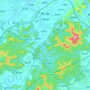
Name: 黄江镇 topographic map, elevation, terrain.
Location: 黄江镇, 东莞市, 广东省, 中国 (22.80016 113.92742 22.93904 114.05579)
Average elevation: 203 ft
Minimum elevation: 7 ft
Maximum elevation: 1,404 ft
Other topographic maps
Click on a map to view its topography, its elevation and its terrain.