
小坑村 topographic map
Interactive map
Click on the map to display elevation.
About this map
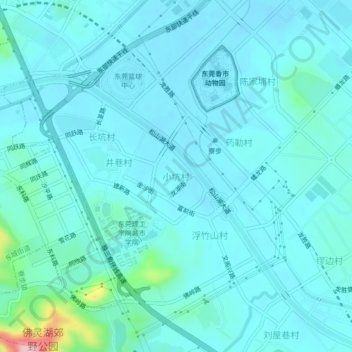
Name: 小坑村 topographic map, elevation, terrain.
Location: 小坑村, 东莞市, 广东省, 523812, 中国 (22.96799 113.82149 23.00799 113.86149)
Average elevation: 69 ft
Minimum elevation: -7 ft
Maximum elevation: 591 ft
Other topographic maps
Click on a map to view its topography, its elevation and its terrain.