
沙田镇 topographic map
Interactive map
Click on the map to display elevation.
About this map
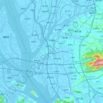
Name: 沙田镇 topographic map, elevation, terrain.
Location: 沙田镇, 东莞市, 广东省, 中国 (22.80776 113.53648 22.99521 113.65095)
Average elevation: 30 ft
Minimum elevation: -56 ft
Maximum elevation: 909 ft
Other topographic maps
Click on a map to view its topography, its elevation and its terrain.