
大岭山镇 topographic map
Interactive map
Click on the map to display elevation.
About this map
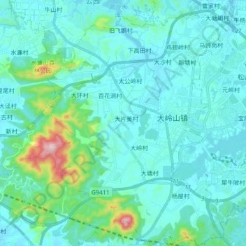
Name: 大岭山镇 topographic map, elevation, terrain.
Location: 大岭山镇, 东莞市, 广东省, 523812, 中国 (22.83550 113.76587 22.96528 113.87345)
Average elevation: 243 ft
Minimum elevation: 39 ft
Maximum elevation: 1,680 ft
Other topographic maps
Click on a map to view its topography, its elevation and its terrain.