
金井镇 topographic map
Interactive map
Click on the map to display elevation.
About this map
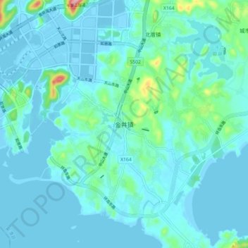
Name: 金井镇 topographic map, elevation, terrain.
Location: 金井镇, 福州市, 福建省, 中国 (25.41233 119.68844 25.49233 119.76844)
Average elevation: 62 ft
Minimum elevation: -16 ft
Maximum elevation: 518 ft
Other topographic maps
Click on a map to view its topography, its elevation and its terrain.