
马尾镇 topographic map
Interactive map
Click on the map to display elevation.
About this map
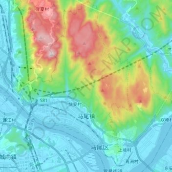
Name: 马尾镇 topographic map, elevation, terrain.
Location: 马尾镇, 马尾区, 福州市, 福建省, 350015, 中国 (25.98445 119.36277 26.10267 119.45789)
Average elevation: 722 ft
Minimum elevation: -7 ft
Maximum elevation: 2,979 ft
Other topographic maps
Click on a map to view its topography, its elevation and its terrain.