
鼓山镇 topographic map
Interactive map
Click on the map to display elevation.
About this map
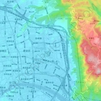
Name: 鼓山镇 topographic map, elevation, terrain.
Location: 鼓山镇, 晋安区, 福州市, 福建省, 350014, 中国 (26.03842 119.32999 26.13174 119.40166)
Average elevation: 499 ft
Minimum elevation: 0 ft
Maximum elevation: 2,979 ft
Other topographic maps
Click on a map to view its topography, its elevation and its terrain.