
军庄镇 topographic map
Interactive map
Click on the map to display elevation.
About this map
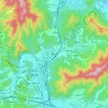
Name: 军庄镇 topographic map, elevation, terrain.
Location: 军庄镇, 门头沟区, 北京市, 102399, 中国 (39.96253 116.05716 40.04253 116.13716)
Average elevation: 906 ft
Minimum elevation: 236 ft
Maximum elevation: 2,651 ft
Other topographic maps
Click on a map to view its topography, its elevation and its terrain.