
丁家滩村 topographic map
Interactive map
Click on the map to display elevation.
About this map
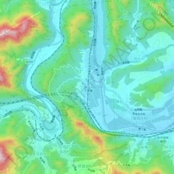
Name: 丁家滩村 topographic map, elevation, terrain.
Location: 丁家滩村, 门头沟区, 北京市, 中国 (39.96080 116.00977 40.00080 116.04977)
Average elevation: 781 ft
Minimum elevation: 436 ft
Maximum elevation: 1,893 ft
Other topographic maps
Click on a map to view its topography, its elevation and its terrain.