
潭柘寺镇 topographic map
Interactive map
Click on the map to display elevation.
About this map
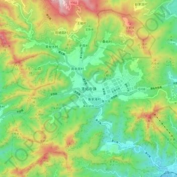
Name: 潭柘寺镇 topographic map, elevation, terrain.
Location: 潭柘寺镇, 门头沟区, 北京市, 中国 (39.83731 115.98481 39.91731 116.06481)
Average elevation: 1,204 ft
Minimum elevation: 331 ft
Maximum elevation: 2,772 ft
Other topographic maps
Click on a map to view its topography, its elevation and its terrain.