
阳台山 topographic map
Interactive map
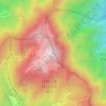
Click on the map to display elevation.
About this map
Name: 阳台山 topographic map, elevation, terrain.
Location: 阳台山, 门头沟区, 北京市, 中国 (40.07905 116.04666 40.07915 116.04676)
Average elevation: 3,058 ft
Minimum elevation: 1,604 ft
Maximum elevation: 4,177 ft
阳台山位于海淀区西北部的苏家坨地区(原属北安河乡)境内,毗邻鹫峰、妙峰山、凤凰岭。主峰海拔1276米,是海淀区的最高点。山顶有经典标记玛尼堆。山脚下设有以法国医生贝熙业为主题的红色教育基地贝家花园。
Other topographic maps
Click on a map to view its topography, its elevation and its terrain.