Geolocate

Jamuria topographic map

Click on the map to display elevation.

About this map

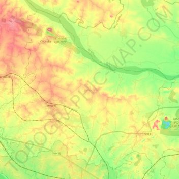
Name: Jamuria topographic map, elevation, terrain.

Location: Jamuria, Paschim Bardhaman, West Bengal, India (23.63613 87.00947 23.81951 87.23198)

Average elevation: 358 ft

Minimum elevation: 151 ft

Maximum elevation: 587 ft

Gear up for your next adventure:

📱Solar Portable Charger - Solar power bank for charging devices off‑grid
🔦LED Headlamp - Bright and durable LED headlamp for night navigation
🪑Portable Camp Table - Compact table for campsite meals
😴Insulated Sleeping Pads - Compact and warm pads for high-elevation camping
🔋Solar Power Banks - Keep your GPS and phone charged in remote wilderness areas

As an Amazon Associate, this site earns from qualifying purchases at no extra cost to you.