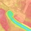
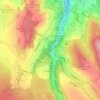
Dresden topographic map
Click on the map to display elevation.
Dresden
Dresden lies on both banks of the Elbe, mostly in the Dresden Basin, with the further reaches of the eastern Ore Mountains to the south, the steep slope of the Lusatian granitic crust to the north, and the Elbe Sandstone Mountains to the east at an altitude of about 113 metres (371 feet). Triebenberg is the highest point in Dresden at 384 metres (1,260 feet).
About this map
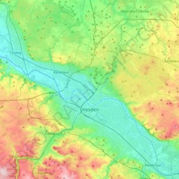
Name: Dresden topographic map, elevation, terrain.
Location: Dresden, Saxony, Germany (50.97494 13.57932 51.17772 13.96606)
Average elevation: 669 ft
Minimum elevation: 318 ft
Maximum elevation: 1,434 ft
Other topographic maps
Click on a map to view its topography, its elevation and its terrain.

Ore Mountains
The higher altitudes from around 500 m above sea level on the German side belong to the Ore Mountains/Vogtland Nature Park – the largest of its kind in Germany with a length of 120 km. The eastern Ore Mountains are protected landscape. Other smaller areas on the German and Czech sides are protected as nature…
Average elevation: 1,453 ft
Georgenfeld
Germany > Saxony > Sächsische Schweiz-Osterzgebirge > Altenberg
Average elevation: 2,703 ft
Saxon Switzerland
Germany > Saxony > Sächsische Schweiz-Osterzgebirge
Saxon Switzerland forms the northern part of the Elbe Sandstone Mountains range, located on the German-Czech border. To the east, it transitions into the Lusatian Highlands and, to the west, into the Ore Mountains. The Czech part of the Elbe Sandstone Mountains is partly formed by the Bohemian Switzerland…
Average elevation: 1,119 ft

Fürstenwalde
Germany > Saxony > Sächsische Schweiz-Osterzgebirge > Altenberg
Average elevation: 2,152 ft
Reinhardtsgrimma
Germany > Saxony > Sächsische Schweiz-Osterzgebirge > Glashütte
Average elevation: 1,220 ft
Bockstein
Germany > Saxony > Sächsische Schweiz-Osterzgebirge > Bad Schandau
Average elevation: 748 ft

Berreuth
Germany > Saxony > Sächsische Schweiz-Osterzgebirge > Dippoldiswalde
Average elevation: 1,273 ft

Markersbach
Germany > Saxony > Erzgebirgskreis
In 1889, Markersbach was connected to the railway line from Schwarzenberg to Annaberg, which was closed to passenger transport on 27 September 1997. The station lay in Mittweida’s municipal area and the platform signs read Mittweida-Markersbach. To overcome the great elevation differential, the railway's…
Average elevation: 1,969 ft




Topograph
Germany > Saxony > Sächsische Schweiz-Osterzgebirge > Rosenthal-Bielatal
Average elevation: 1,263 ft