Geolocate

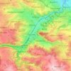
Ore Mountains topographic map

Click on the map to display elevation.

Ore Mountains

The higher altitudes from around 500 m above sea level on the German side belong to the Ore Mountains/Vogtland Nature Park – the largest of its kind in Germany with a length of 120 km. The eastern Ore Mountains are protected landscape. Other smaller areas on the German and Czech sides are protected as nature reserves and natural monuments. On the ridges there are also several larger raised bogs that are only fed by rainwater. The mountains are popular for hiking and there are winter sports areas at higher elevations. In 2019, the region became a UNESCO World Heritage Site.

Wikipedia (CC-BY-SA 3.0)

About this map

Name: Ore Mountains topographic map, elevation, terrain.

Location: Ore Mountains, Saxony, Germany (50.19257 12.30729 51.02584 14.04725)

Average elevation: 1,453 ft

Minimum elevation: 292 ft

Maximum elevation: 4,062 ft

Other topographic maps

Click on a map to view its topography, its elevation and its terrain.

Rosine

Germany > Saxony > Mittelsachsen > Freiberg

Average elevation: 1,378 ft

Ullersdorf

Germany > Saxony > Mittelsachsen > Sayda

Average elevation: 2,113 ft

Leipzig

Germany > Saxony > Leipzig

Average elevation: 417 ft

Dresden

Germany > Saxony > Dresden

Average elevation: 778 ft

Kleinzschocher

Germany > Saxony > Leipzig

Average elevation: 387 ft

Mehltheuer

Germany > Saxony > Vogtlandkreis

Average elevation: 1,644 ft

Meissen

Germany > Saxony > Meißen

Average elevation: 535 ft

Hammerbach-Seitenquelle

Germany > Saxony > Dresden

Average elevation: 896 ft

Ansprung

Germany > Saxony > Erzgebirgskreis > Marienberg

Average elevation: 2,169 ft

Mittweida

Germany > Saxony > Mittelsachsen

Average elevation: 971 ft

Plauen

Germany > Saxony > Vogtlandkreis

Average elevation: 1,407 ft

Dresden

Germany > Saxony

Dresden lies on both banks of the Elbe, mostly in the Dresden Basin, with the further reaches of the eastern Ore Mountains to the south, the steep slope of the Lusatian granitic crust to the north, and the Elbe Sandstone Mountains to the east at an altitude of about 113 metres (371 feet). Triebenberg is the…

Average elevation: 669 ft

Löbau

Germany > Saxony > Görlitz

Average elevation: 896 ft

04862

Germany > Saxony > Nordsachsen > Mockrehna > Audenhain

Average elevation: 351 ft

Gippe

Germany > Saxony > Vogtlandkreis > Elsterberg

Average elevation: 1,175 ft

Freiberg

Germany > Saxony > Mittelsachsen

The town lies on the northern declivity of the Ore Mountains, with the majority of the borough west of the Eastern or Freiberger Mulde river. Parts of the town are nestled in the valleys of Münzbach and Goldbach streams. Its centre has an altitude of about 412 m above sea level (NHN) (at the railway station).…

Average elevation: 1,329 ft

Leipzig

Germany > Saxony

Average elevation: 413 ft

Elstertrebnitz

Germany > Saxony > Landkreis Leipzig

Average elevation: 453 ft

Wilkau-Haßlau

Germany > Saxony > Zwickau

Average elevation: 1,129 ft

Werdau

Germany > Saxony > Zwickau

Average elevation: 1,076 ft

Dresden

Germany > Saxony

Dresden lies on both banks of the Elbe, mostly in the Dresden Basin, with the further reaches of the eastern Ore Mountains to the south, the steep slope of the Lusatian granitic crust to the north, and the Elbe Sandstone Mountains to the east at an altitude of about 113 metres (371 feet). Triebenberg is the…

Average elevation: 669 ft

Upper Lusatia

Germany > Saxony

The highest elevations of the German part of Upper Lusatia are in the Zittau Mountains (Lusatian Ridge), part of the Lusatian Mountains forming the border with the adjacent Bohemian region in the south, which today belong to the Czech Republic. The highest peaks of the Zittau Mountains are the Lausche at 792.6…

Average elevation: 853 ft

Bernsdorf

Germany > Saxony > Zwickau

Average elevation: 1,076 ft

Leipzig

Germany > Saxony

Average elevation: 413 ft

02957

Germany > Saxony > Görlitz > Krauschwitz - Krušwica > Pechern

Average elevation: 449 ft

02956

Germany > Saxony > Görlitz > Rietschen - Rěčicy > Daubitz

Average elevation: 479 ft

02943

Germany > Saxony > Görlitz > Boxberg/O.L. - Hamor > Boxberg/O.L.

Average elevation: 436 ft

Flax

Germany > Saxony > Sächsische Schweiz-Osterzgebirge > Lohmen

Average elevation: 751 ft

Görlitz

Germany > Saxony > Görlitz

Average elevation: 732 ft

Borsdorf

Germany > Saxony > Landkreis Leipzig

Average elevation: 427 ft

Meissen

Germany > Saxony > Meißen

Average elevation: 535 ft

Dresden

Germany > Saxony

Dresden lies on both banks of the Elbe, mostly in the Dresden Basin, with the further reaches of the eastern Ore Mountains to the south, the steep slope of the Lusatian granitic crust to the north, and the Elbe Sandstone Mountains to the east at an altitude of about 113 metres (371 feet). Triebenberg is the…

Average elevation: 669 ft

Sebnitz

Germany > Saxony > Sächsische Schweiz-Osterzgebirge

The town of Sebnitz lies in the valley of the river Sebnitz and its side valleys between 251 and 460 m above sea level between the mountains of Saxon Switzerland and the Lusatian Highlands. Topographically the town itself lies in the West Lusatian Upland, but lies right on the border with the Upper Lusatian…

Average elevation: 1,122 ft

Clausnitz

Germany > Saxony > Mittelsachsen

Average elevation: 1,998 ft

Torgau

Germany > Saxony > Nordsachsen

Average elevation: 302 ft

Gohrisch

Germany > Saxony > Sächsische Schweiz-Osterzgebirge

Average elevation: 1,063 ft

Mittelsachsen

Germany > Saxony

Average elevation: 1,132 ft

Holzhau

Germany > Saxony > Mittelsachsen

Average elevation: 2,379 ft

Freiberg

Germany > Saxony > Mittelsachsen

The town lies on the northern declivity of the Ore Mountains, with the majority of the borough west of the Eastern or Freiberger Mulde river. Parts of the town are nestled in the valleys of Münzbach and Goldbach streams. Its centre has an altitude of about 412 m above sea level (NHN) (at the railway station).…

Average elevation: 1,329 ft

Leipzig

Germany > Saxony

Average elevation: 413 ft

Leipzig

Germany > Saxony

Average elevation: 413 ft

Reichenbach

Germany > Saxony > Vogtlandkreis

Average elevation: 1,316 ft

Auerbach/Vogtland

Germany > Saxony > Vogtlandkreis

Average elevation: 1,923 ft

08058

Germany > Saxony > Zwickau > Zwickau

Average elevation: 981 ft

Leppersdorf

Germany > Saxony > Bautzen - Budyšin

Average elevation: 889 ft

Baruth - Bart

Germany > Saxony > Bautzen - Budyšin

Average elevation: 515 ft

Görlitz

Germany > Saxony > Görlitz

Average elevation: 732 ft

Zittau

Germany > Saxony > Görlitz

Average elevation: 1,066 ft

Ottendorf-Okrilla

Germany > Saxony > Bautzen - Budyšin

Average elevation: 633 ft

Rodewisch

Germany > Saxony > Vogtlandkreis

Average elevation: 1,608 ft

Gaußig - Huska

Germany > Saxony > Bautzen - Budyšin

Average elevation: 876 ft

Markkleeberg

Germany > Saxony > Landkreis Leipzig

Average elevation: 397 ft

Bautzen

Germany > Saxony > Bautzen - Budyšin

Average elevation: 689 ft

Neurobschütz

Germany > Saxony > Meißen > Robschütz

Average elevation: 673 ft

Wachau

Germany > Saxony > Bautzen - Budyšin

Average elevation: 768 ft

Bad Düben

Germany > Saxony > Nordsachsen

Average elevation: 322 ft

Mittweida

Germany > Saxony > Mittelsachsen

Average elevation: 968 ft

Mulde

Germany > Saxony

Average elevation: 364 ft

Ehrenfriedersdorf

Germany > Saxony > Erzgebirgskreis

Average elevation: 1,909 ft

Colditz

Germany > Saxony > Landkreis Leipzig

Average elevation: 656 ft

Ostritz

Germany > Saxony > Görlitz

Average elevation: 876 ft

Chemnitz

Germany > Saxony

Average elevation: 1,214 ft

Elster

Germany > Saxony > Görlitz > Zittau

Average elevation: 1,470 ft

Aue

Germany > Saxony > Erzgebirgskreis

Average elevation: 1,526 ft

Niesky

Germany > Saxony > Görlitz - Zhorjelc

Average elevation: 541 ft

Markersbach

Germany > Saxony > Erzgebirgskreis

In 1889, Markersbach was connected to the railway line from Schwarzenberg to Annaberg, which was closed to passenger transport on 27 September 1997. The station lay in Mittweida’s municipal area and the platform signs read Mittweida-Markersbach. To overcome the great elevation differential, the railway's…

Average elevation: 1,969 ft
Hartenstein

Germany > Saxony > Zwickau

Average elevation: 1,411 ft

Schlauroth

Germany > Saxony > Görlitz > Görlitz

Average elevation: 787 ft

Podelwitz

Germany > Saxony > Nordsachsen

Average elevation: 413 ft

Grimma

Germany > Saxony > Landkreis Leipzig

Average elevation: 531 ft

Elsnig

Germany > Saxony > Nordsachsen

Average elevation: 299 ft

Waldheim

Germany > Saxony > Mittelsachsen

Average elevation: 856 ft

Marienberg

Germany > Saxony > Erzgebirgskreis

The town is situated on a plateau north of the Ore Mountains ridge, at an elevation between 460 and 891 metres above sea level. It is approximately 31 kilometres south of Chemnitz, to which it is connected via the Flöha Valley Railway.

Average elevation: 2,156 ft
Nossen

Germany > Saxony > Meißen

Average elevation: 797 ft

Schneeberg

Germany > Saxony > Erzgebirgskreis

Average elevation: 1,637 ft

Boxberg/O.L. - Hamor

Germany > Saxony > Görlitz

Average elevation: 433 ft

Seifersdorf

Germany > Saxony > Mittelsachsen > Hartha

Average elevation: 814 ft

Leipzig

Germany > Saxony

Average elevation: 413 ft

Leipzig

Germany > Saxony

Average elevation: 413 ft

Mühlleithen

Germany > Saxony > Vogtlandkreis > Klingenthal

Average elevation: 2,707 ft

Zwickau

Germany > Saxony > Zwickau

Average elevation: 1,079 ft

Frauenstein

Germany > Saxony > Mittelsachsen

Average elevation: 1,949 ft

Gear up for your next adventure:

📶Satellite Messenger - Communication device off‑grid
🩹Survival Bandages - High‑quality bandages for emergencies
🔦Powerful Headlamps - Ultra-bright hands-free lighting for night navigation
🗺️Topographic Maps - Detailed topo maps for hiking, exploring and outdoor navigation
🔥Camping Stove - Portable stove for camping and backcountry cooking

As an Amazon Associate, this site earns from qualifying purchases at no extra cost to you.