
东望山乡 topographic map
Interactive map
Click on the map to display elevation.
About this map
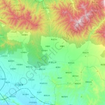
Name: 东望山乡 topographic map, elevation, terrain.
Location: 东望山乡, 桥东区, 张家口市, 河北省, 075000, 中国 (40.69717 115.02765 40.83101 115.25778)
Average elevation: 3,406 ft
Minimum elevation: 2,208 ft
Maximum elevation: 5,912 ft
Other topographic maps
Click on a map to view its topography, its elevation and its terrain.