
Kongsberg topographic map
Interactive map
Click on the map to display elevation.
About this map
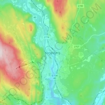
Name: Kongsberg topographic map, elevation, terrain.
Location: Kongsberg, Viken, 3613, Norwegen (59.62950 9.61085 59.70950 9.69085)
Average elevation: 909 ft
Minimum elevation: 420 ft
Maximum elevation: 2,073 ft
Other topographic maps
Click on a map to view its topography, its elevation and its terrain.
Hammern
Norwegen > Viken > Fredrikstad > Torsnes
Hammern, Torsnes, Fredrikstad, Viken, Norwegen
Average elevation: 98 ft