
Råde topographic map
Interactive map
Click on the map to display elevation.
About this map
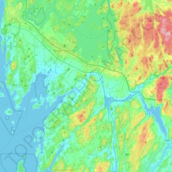
Name: Råde topographic map, elevation, terrain.
Location: Råde, Viken, Norwegen (59.25232 10.59033 59.41104 10.97797)
Average elevation: 125 ft
Minimum elevation: -10 ft
Maximum elevation: 574 ft
Other topographic maps
Click on a map to view its topography, its elevation and its terrain.
Hammern
Norwegen > Viken > Fredrikstad > Torsnes
Hammern, Torsnes, Fredrikstad, Viken, Norwegen
Average elevation: 98 ft