
龙池街道 topographic map
Interactive map
Click on the map to display elevation.
About this map
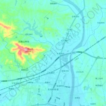
Name: 龙池街道 topographic map, elevation, terrain.
Location: 龙池街道, 麻城市, 黄冈市, 湖北省, 中国 (31.17211 114.98775 31.26412 115.05196)
Average elevation: 272 ft
Minimum elevation: 154 ft
Maximum elevation: 1,050 ft
Other topographic maps
Click on a map to view its topography, its elevation and its terrain.