
南岔县 topographic map
Interactive map
Click on the map to display elevation.
About this map
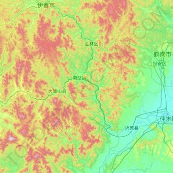
Name: 南岔县 topographic map, elevation, terrain.
Location: 南岔县, 伊春市, 黑龙江省, 153000, 中国 (46.35453 128.66213 47.75453 130.06213)
Average elevation: 1,237 ft
Minimum elevation: 240 ft
Maximum elevation: 4,623 ft
Other topographic maps
Click on a map to view its topography, its elevation and its terrain.