
蛟河市 topographic map
Interactive map
Click on the map to display elevation.
About this map
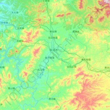
Name: 蛟河市 topographic map, elevation, terrain.
Location: 蛟河市, 吉林市, 吉林省, 中国 (43.20610 126.74653 44.14457 127.91890)
Average elevation: 1,637 ft
Minimum elevation: 679 ft
Maximum elevation: 5,492 ft
Other topographic maps
Click on a map to view its topography, its elevation and its terrain.